|
Britain
Le travail des collègues et des éditeurs
(MDI, DPF ou La Documentation photographique...) fait parfois gagner du
temps :-)
Oxford
Google Earth ignore Oxford (et Ashford).
Par contre il y a des vues excellentes
chez Microsoft, notamment celle-ci avec la Bodleian,
à proximité de Broad street (et
de Blackwell 's)
http://clioweb.free.fr/images/uk/oxford2.jpg
http://www.flashearth.com/?lat=51.753993&lon=-1.256107&z=17.6&r=0&src=msl
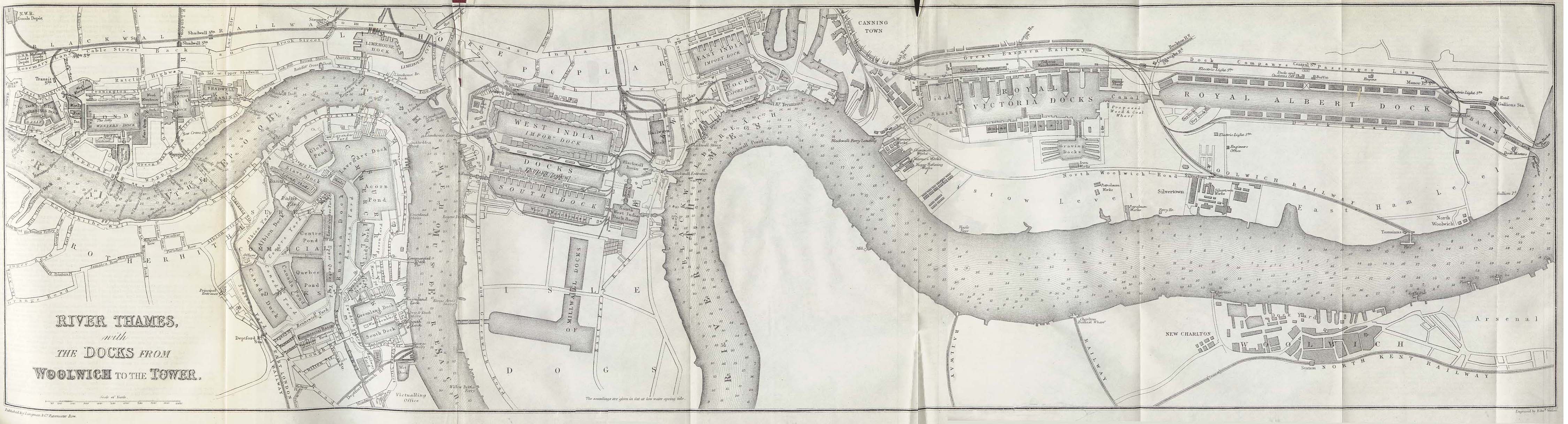
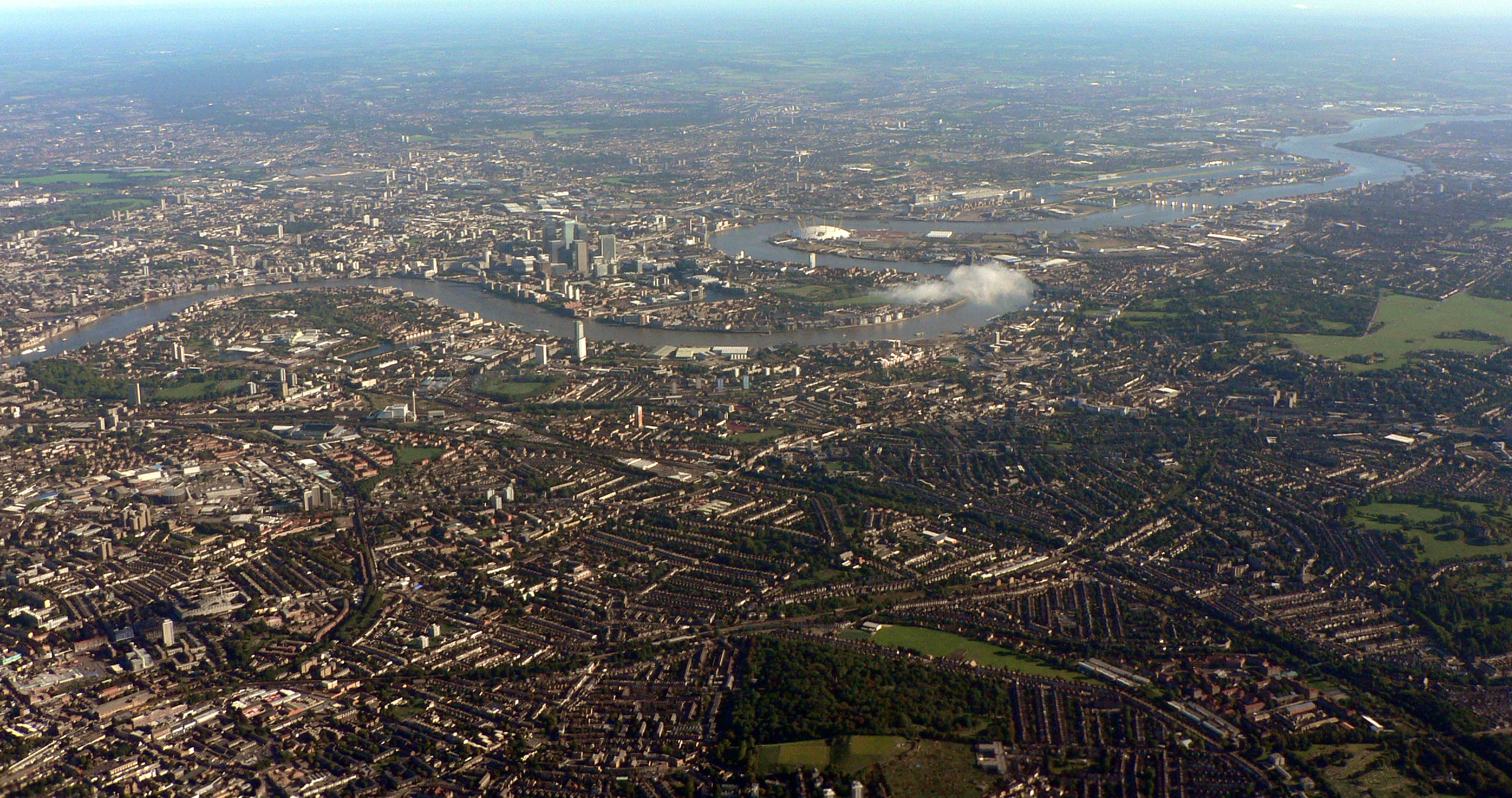
La rénovation des docks de Londres
est traitée dans Métropoles en mutation (CNDP).
Sur les Docks voir aussi :
Canary
(flashearth)
Canary (Andrew
Stacey 2002)
London Docklands History for GCSE : http://www.bardaglea.org.uk/docklands/1-sitemap.html
une carte ancienne : http://www.lib.utexas.edu/maps/historical/thames_river_1882.jpg
LDDC : http://www.lddc-history.org.uk/scrapbook/index.html
Canary
Wharf
isle
of dogs, vue globale
Westminster
Google Earth et Live Local (Virtual Earth) se
complètent.
(Live Local a été utilisé
via http://www.flashearth.com ,
un peu lent, mais incontournable avec Windows
98.
Milton Keynes :
Les 2 servent pour d'étudier Milton Keynes
http://clioweb.free.fr/images/uk/mk1.jpg
http://clioweb.free.fr/images/uk/mklive.jpg
Milton Keynes
avec
flash earth
Open
Guide
carte
de MK
vue aérienne avec Google Maps ou G Earth
Pour le reste du RU, les photos ne manquent pas
sur le web, mais elles ne répondent pas toujours à la demande.
Birmingham :
http://www.webbaviation.co.uk/birmingham/birmingham.htm
Liverpool (et Manchester sur le même site)
:
http://www.aerial-photographer.co.uk/Liverpool/index.htm
d'autres adresses, en vrac :
Ashford
Ashford
centre
Canterbury
(David Rayner)
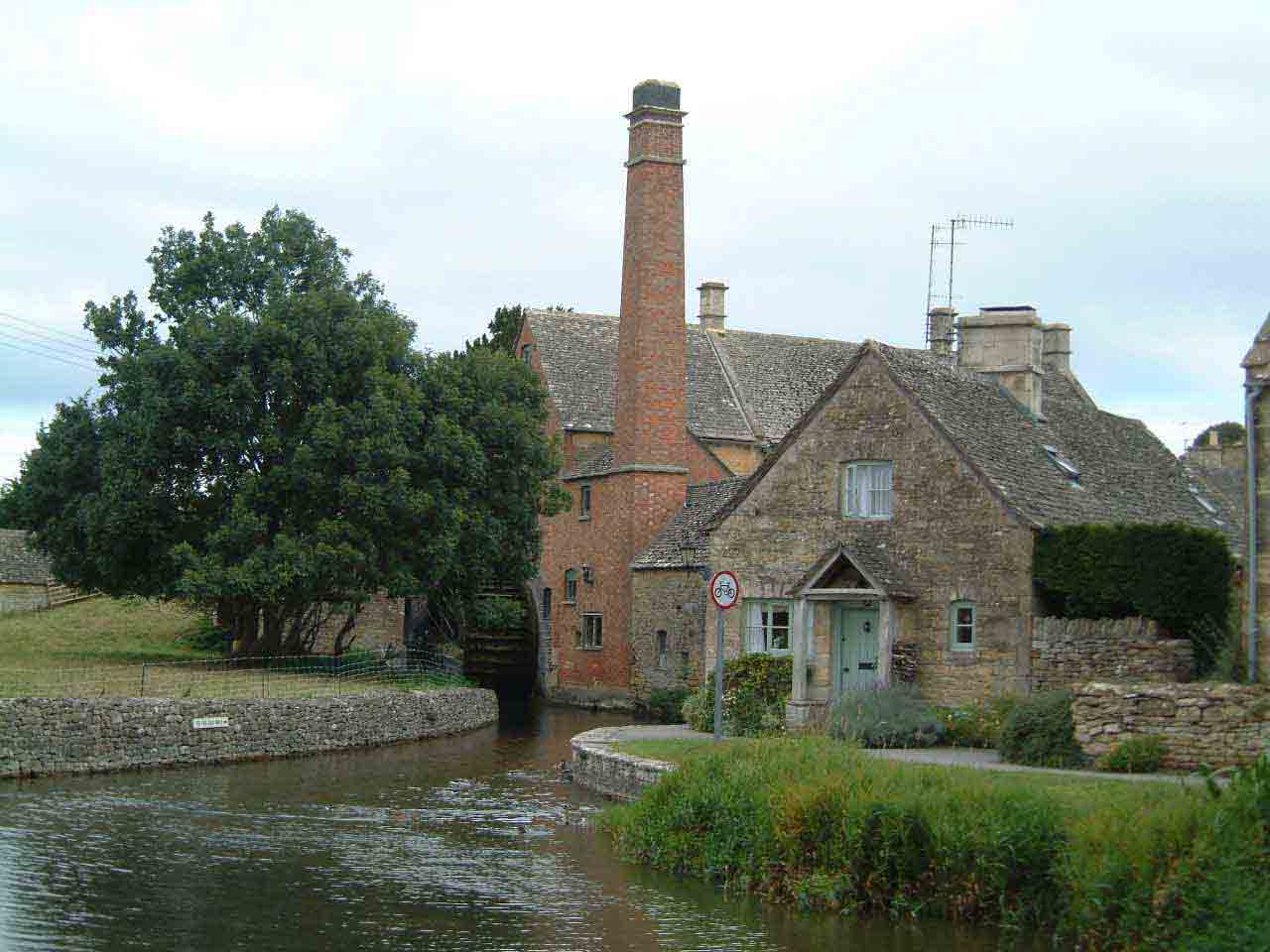
Low
Slaughter un village des Cotswolds
Le même village,
aujourd'hui selon Google images - selon
flashearth
le
moulin
Burford
Newcastle
(Kay)
Il est possible d'explorer des collections de
photos,
comme A Digital Picture of Britain sur le site
de la BBC :
http://www.bbc.co.uk/arts/apictureofbritain/gallery/
ou celle d'un collègue (Andrew Stacey)
:
http://www.stacey.peak-media.co.uk/gallery.htm
ou encore le travail des peintres sur le site
de la Tate :
http://www.tate.org.uk/britain/exhibitions/apictureofbritain/map.shtm
avec l'exemple d'Oxford : http://www.tate.org.uk/britain/exhibitions/apictureofbritain/heart_of_england.shtm
et Viewfinder "a new website from English
Heritage".
It contains over 20,000 digital images of historic
buildings, places and people dating from the 1840s
http://viewfinder.english-heritage.org.uk/
Simon Kirwan 's The
Ligth Box
Geograph : "Photograph every grid square
in the UK"
une couverture en images, y compris par des photographes
amateurs http://www.geograph.co.uk/
The National Trust, page éducation
http://www.nationaltrust.org.uk/
DL 2006-2012 |